
Introduction
Human Geography is the study of human society and human culture from the perspective of place. In this class we will learn that the kinds of lives people live and the cultures they create are deeply influenced by where they live, by the climate and landscape, by the kinds of agriculture and industry that is practiced there, and by the ways people cooperate with, learn from, or compete with other cultures in other places.
Beginning with the obvious, the Earth is a sphere.
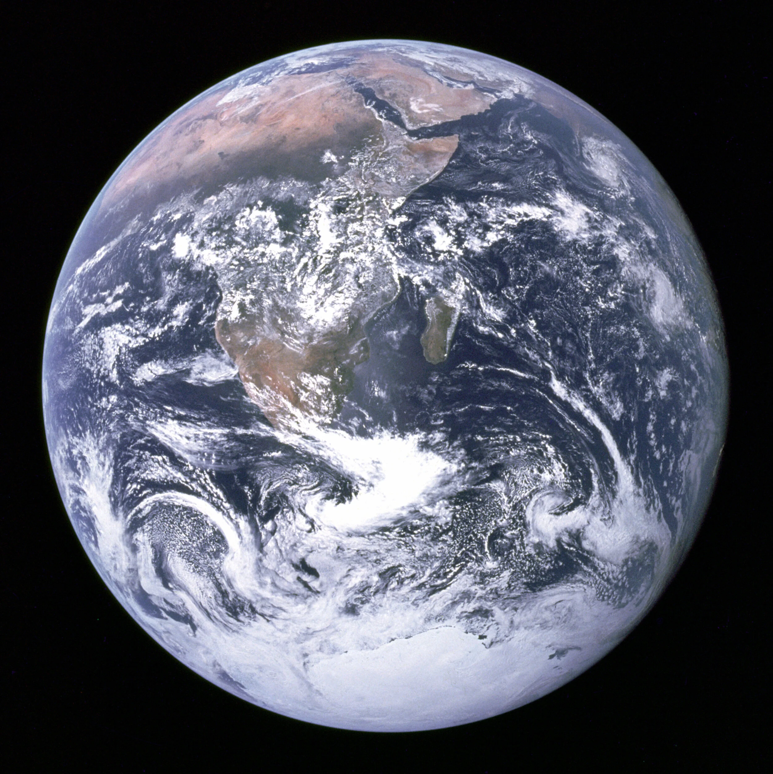
The Earth Seen from Apollo 17, December 7, 1972.
The earth is about 24,901 miles in circumference if measured around the equator and slightly less if measured from pole to pole (Which makes planet earth an oblate spheroid rather than a perfect sphere). To put that distance into perspective, the average American drives about 25,000 miles over the course of two years, not going anywhere in particular, just going to work, shopping, and putting miles on the car. Among the objects in our planetary neighborhood, Earth is a middleweight, rocky planet—bigger than Mercury and Mars, but much smaller than the gas giants Jupiter and Saturn. It occupies an orbital path that some astronomers call the Goldilocks Zone: It is not so close to the sun that all of planet’s water boils away, nor so cold that Earth is locked in an eternal deep freeze. Earth’s place in the solar system, is, as Goldilocks would have said, just right. Earth occupies a zone where, for the most part, water can exist as a liquid, solid, and gas, providing us with oceans and clouds, lakes, glaciers, and, of some importance to us, the possibility of life.
The earth spins on its axis, once every 24 hours, and as it revolves around the sun, the axis tilts 23.5 degrees. This means that, on the winter solstice, the North Pole is turned away from the sun by 23.5 degrees and on the summer solstice, it is turned toward the sun by 23.5 degrees. On the autumnal and vernal equinoxes, the two poles are at a 90 degree angle to the sun.

The earth rotating on its axis. Wikipedia Creative Commons.
The details of this astronomical description are more properly a subject for physical rather than human geography, but this continually tilting of the earth’s axis as it circles the sun gives the earth its seasons and climates On the day (June 21) when the northern hemisphere is pointed toward the sun (the summer solstice), that part of the globe experiences summer. At the same time, the southern hemisphere is experiencing the beginning of winter (the winter solstice). Kids in Australia, Brazil and South Africa celebrate Christmas at the beginning of the summer.
Earth’s orbit around the sun is not a perfect circle either. The earth travels around the sun in an elliptical orbit. It is farthest from the sun in early January and closest in early July. This has nothing to do with the seasons of the year or the temperature on earth. It is the tilt of the earth’s axis towards or away from the sun that causes the seasons to change and for all of the earth’s plants and animals to respond to those seasonal changes.
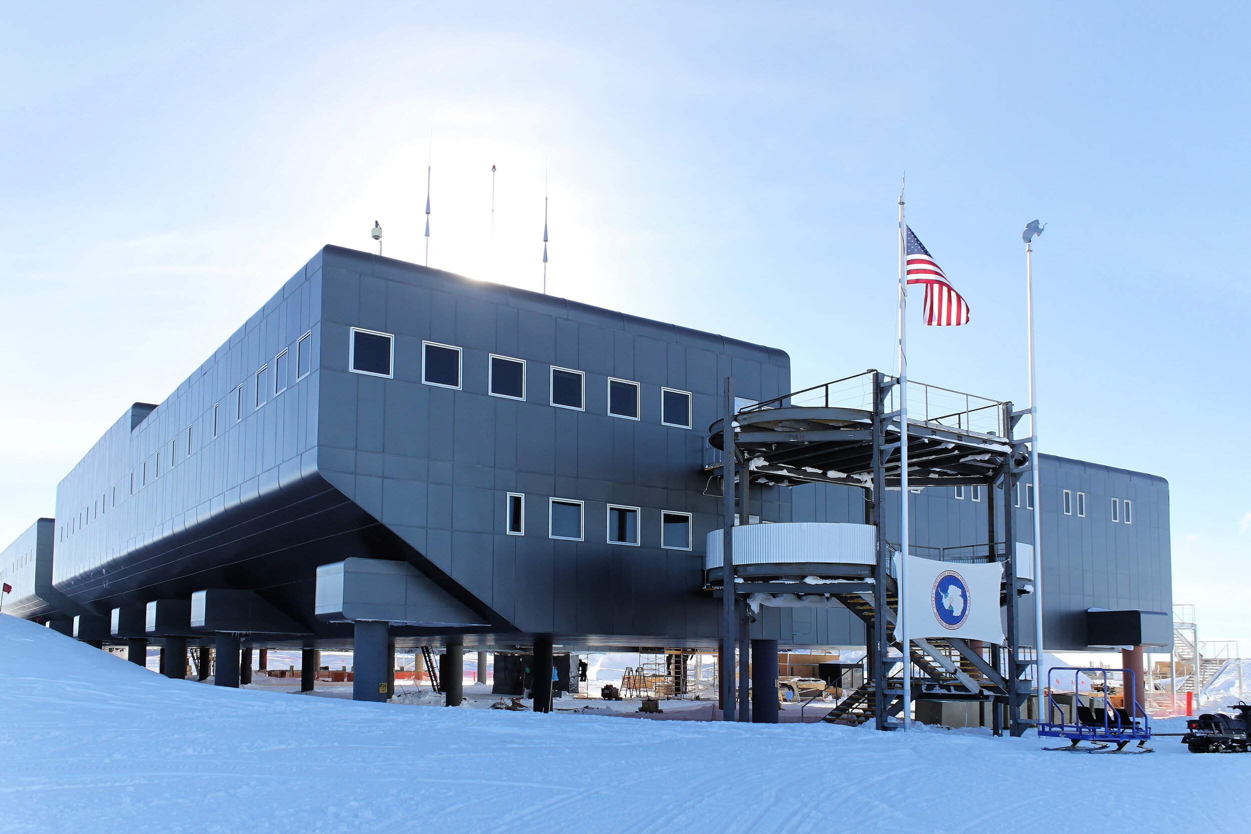
The Amundsen-Scott South Pole Station. Image by Daniel Leussler / CC BY-SA
If you were to spend the southern summer (December 21 to March 21) at the Amundsen-Scott South Pole Station in Antartica, you would enjoy a continuous daytime lasting for six months. The sun would circle through the sky every twenty-four hours, coming closer to the horizon as the autumnal equinox approached, but it would not set until the first day of autumn and would not rise again for six months. And, on the day the sun finally set at the south pole, at the north pole it would rise above the horizon for six months of uninterrupted polar sunshine.
From either the north or south poles, you could travel in any direction for about 1,650 miles and reach the Arctic Circle (in the north) or Antarctic Circle (in the south). At the Arctic or Antarctic circles, the sun will remain visible for a full 24 hours. As you get closer and closer to the pole, the days of unbroken sunshine increase until, at the top of the world, the day lasts for six months.
Still, even when the sun shown at midnight, it would not be far from the horizon.

The midnight sun in arctic Russia, captured in a time-lapse photograph. Виктор Габышев / CC BY-SA (https://creativecommons.org/licenses/by-sa/4.0)
The continent of Antartica, most of which is covered in ice several thousands of feet thick, is uninhabited except for a few thousand scientists and adventurers who live there temporarily in order to conduct research. Except for the coastal regions which are rich in sea life, Antartica does not provide the resources necessary to sustain human or virtually any other kind of life. The South Pole station must be supplied regularly from home with food, heating fuel, diesel, and everything else people need to spend a part of their lives in so unwelcoming an environment.
In the latitudes around the equator, of course, things are vastly different. Remember that the earth has a 23.5 degree tilt in its axis, and that the northern axis tilts toward the sun by 23.5 degrees on the first day of summer (the summer solstice). This means that, if you were enjoying a tropical vacation in the Bahamas on June 21, 2020, you would notice that, at noon the sun would be precisely overhead. The Bahamas lie, of course, on the Tropics of Cancer, the imaginary line that separates the tropics from the more temperate climate to the north. You could have a similar experience in Australia six months later at the beginning of the southern summer.
Why does any of this matter? Because the earth wobbles on its axis, because the earth occupies the Goldilocks zone between the sun and the frigid reaches of the outer solar system, because the earth rotates on its axis and for that matter, because the earth has a moon that causes the tides to rise and fall, twice a day, the planet we inhabit offers a vast diversity of climates, weather patterns, and habitats. Add to that is the fact that the earth is also lumpy, with bumps, gashes and ridges that, while tiny on a planetary scale, play a huge role in how life has developed on the planet.
The Earth’s diameter is a little less than 8000 miles.

Image Created by Actualist for Wikipedia Commons.
Mount Everest, the highest point on earth, rises to approximately 5.5 miles above sea level, well above the elevation humans can live for more than a few hours. These small differences in elevation provide clues to earth’s deeper structure. The earth’s solid, rocky crust (the part we are standing on) varies from about 18 miles in depth to just two or three in the depths of the ocean. The crust floats on a constantly moving, exceedingly hot mantle and core of molten rock and metal. Where the crust is thin and fractured, the molten rock works its way up to the surface of the earth as volcanoes.
The Mariana Trench, the deepest place in the ocean, is approximately 7 miles below sea level. At that depth, the water applies a pressure of 16,000 pounds per square inch. Not surprisingly, while people can be found almost everywhere on the planet, the vast majority of people live in the more temperate elevations from sea level to a few thousand feet above sea level and in the latitudes stretching north and south from the equator into the temperate zones well south of the Arctic and Antarctic Circles. They also tend to avoid deserts where the rainfall is either too sparse or too sporadic to allow for agriculture.
For the most part, the difference of a few feet in elevation separate dry land from ocean, desert from rainforest, land habitable by people and land hostile to their presence. The boundaries are not always clear and not permanent.

The City of New Orleans lies very close to the average sea level. After Hurricane Katrina in 2005, the levies surrounding the city failed allowing water from Lake Ponchartrain to flood into the city. Photo by Commander Mark Moran, of the NOAA Aviation Weather Center, and Lt. Phil Eastman and Lt. Dave Demers, of the NOAA Aircraft Operations Center.
Yet these small differences make the earth a really interesting, diverse place. Were the earth’s surface perfectly smooth, then the whole of the planet would be covered with a thin layer of water and the study of geography would be substantially less complicated.
But there are bumps and wrinkles on the surface, which limits the oceans, seas, and lakes to 71% of the earth’s surface, and leave the rest to more or less dry land. These physical features of land and sea and atmosphere have provided the setting for all of human history.
The dominant features of planet earth, and the one that sets it apart from the rest of the planets in our solar system, are the oceans and seas. For most of our history, they have set an uncompromising boundary for human activity. Humans lived on the land. They hunted and farmed on the land, and if they built boats and set out to sea, they did so within sight of land.
Only slowly did humans develop the technologies allowing them to sail beyond the horizon and to find their way back to land. Only gradually did the sea lose its terrors—though never completely.
In an effort to control these great expanses of water, people named them. Today we call them the Arctic, Atlantic, Indian, and Pacific Oceans. People have also named the smaller, but still massive bodies of water too numerous to list here, from the Mediterranean Sea to countless garden ponds. People like to name things.
The next great physical feature of planet earth—not unique among the planets but still pretty special—is our atmosphere. Defining how far above the earth’s surface the atmosphere extends into outer space is not especially easy. NASA, which should understand these things, recognizes anyone who has flown fifty miles or more above the earth’s surface as an astronaut—a space traveler. The International Space Station orbits the earth at a height of 248 miles, a distance that is considered low earth orbit and not completely beyond the reach of earth’s atmosphere. Satellites in geo-stationary orbit are much higher—26,199 miles above the center of the earth. At this elevation, they can orbit the earth at precisely the same speed that the earth rotates and thus maintain the same place in the sky relative to the earth and also avoid all but a few stray hydrogen atoms at the outer fringes of the atmosphere.

A geo-stationary orbit. Created by Brandir - Own work. Rendered with PovRay-3.0, https://commons.wikimedia.org/w/index.php?curid=531740.
But, for the vast majority of humans who are not astronauts, the only atmosphere that really matters is the thin sheet of nitrogen, oxygen, and carbon dioxide that wraps the planet in something we can breath. At about five miles—the elevation of Mount Everest and the height at which most commercial aircraft fly—the atmosphere gets too thin to support human life. Climbers of the world’s highest peaks have to carry supplemental oxygen with them, and even then, start to lose brain cells if they stay too long at those deadly heights.
Humans, of course, find the third major feature of planet earth—the continents and islands—to be most compelling, since it is on these bits of dry land that humans have spent most of their existence. Even astronauts may hang out in the International Space Station for a few months, and sailors may attest to their love of the sea, but human beings have always made their homes on land.
The Land Surface Area of planet Earth is about 57.5 million square miles.
The Human Population of Planet Earth is 8 billion people (and growing).

This choropleth map reflects the uneven population density on planet Earth. Image Source: United States Department of Agriculture.
If the earth’s population were to be scattered evenly across the earth’s land mass, the population density would equal 135 people per square mile. But of course, people are not scattered evenly across the earth’s surface. As you know from experience and as this choropleth map indicates, a few places on the earth’s surface (indicated here in deepening shades of red and purple) have extremely high population densities. Bangladesh, for example, has a land area of 55,598 square miles and a population of 168.9 million. Its population density (found by dividing area by population) is 3,038 people per square mile, making it one of the most densely populated countries on the planet. But even in so densely populated a country as Bangladesh, urban areas are far more densely populated than the countryside, and a few areas are set aside as natural preserves with extremely low population density.
Contact
tandymcconnell@icloud.com